A drone helps make a challenging Greenland glacier measurement
DOI: 10.1063/pt.uddo.mmim

Eqalorutsit Kangilliit Sermiat is a vast glacier that lies on bedrock below sea level and stretches into the Arctic waters of Sermilik Fjord off the coast of southern Greenland. When the fronts of such marine-terminating glaciers melt at depth, the meltwater rises through the salty seawater and triggers mixing that affects, among other things, the melting rates of the glacier front and the availability of nutrients for marine life.
Figure 1.

An uncrewed helicopter hovers over Sermilik Fjord in March 2023 as a sensor that was lowered under the surface collects data. (Image adapted from K. Hansen et al., Nat. Geosci. 18, 219, 2025 .)
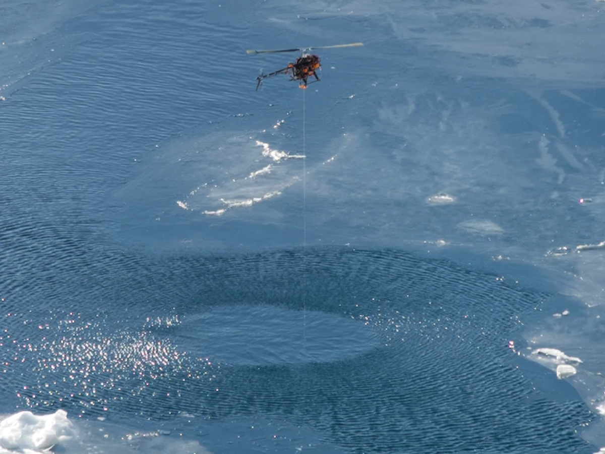
The melting of Eqalorutsit Kangilliit Sermiat and other Greenland glaciers has been measured in the summer but not during the winter, when fjord ice and icebergs permeate the fjords. The lack of data has left researchers unsure of how to factor wintertime melting into climate models and other studies of Greenland’s glaciers and fjords. To help obtain valuable winter data, Nanna Karlsson of the Geological Survey of Denmark and Greenland in Copenhagen and her colleagues fitted a commercial drone helicopter, shown in figure
In March 2023, Karlsson and her Geological Survey colleagues, along with researchers from Aarhus University in Denmark and the Greenland Institute of Natural Resources, navigated the roughly $15 000 custom vehicle out into icy waters several kilometers from the front of Eqalorutsit Kangilliit Sermiat and lowered the sensor as deep as 100 m underwater. The researchers obtained measurements closer to the glacier front by manually drilling through the frozen fjord surface.
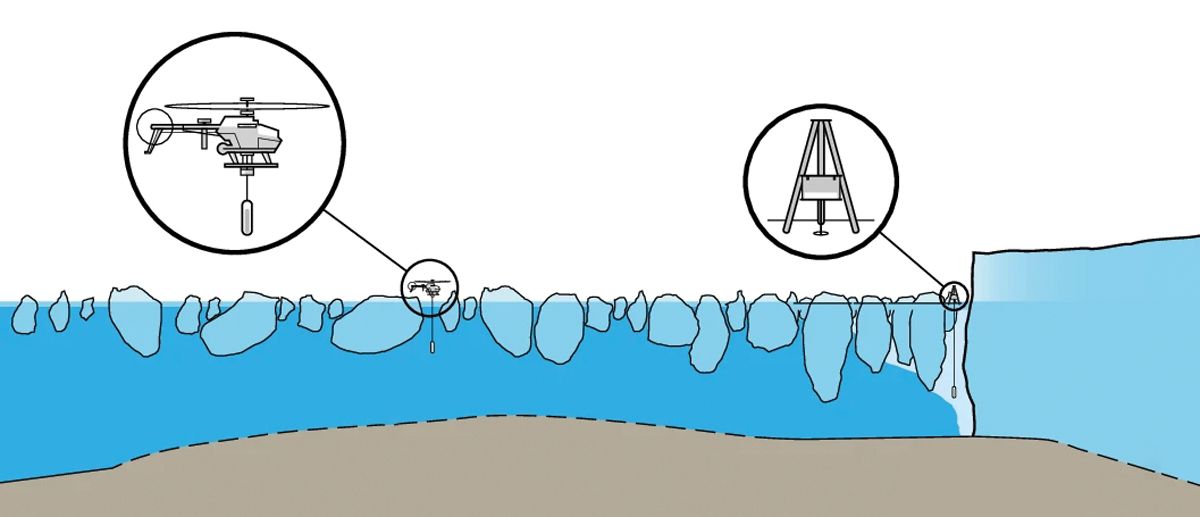
By deploying sensors both beside the glacier front and farther out in the fjord, the researchers were able to compare water properties and determine the potential influence of glacial meltwater. As shown in figure
Figure 2.

Water measurements made via drill close to the glacier front and via drone farther out to sea indicate the existence of a supply of relatively fresh water (light blue beneath the drill) near the glacier. (Image adapted from K. Hansen et al., Nat. Geosci. 18, 219, 2025 .)
Karlsson and colleagues propose that the meltwater originates at the glacier’s base, where ice grinds against bedrock. The winter discharge could affect the conditions of the nearby icy waters and facilitate faster melting rates in the future. Wintertime melting may also nudge nutrients up toward the surface and fuel the phytoplankton bloom that occurs in the area each spring. Future measurements, perhaps aided by drones, could help quantify the climatic, ecological, and other effects of the wintertime melting of glaciers like Eqalorutsit Kangilliit Sermiat. (K. Hansen et al., Nat. Geosci. 18, 219, 2025 .)
This article was originally published online on 28 May 2025.
More about the authors
Andrew Grant, agrant@aip.org


