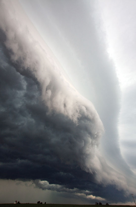
Derecho looming
DOI: 10.1063/PT.3.1690
This photo, taken in Low Moor, Iowa, captured the leading edge of the storm system that went on to wrack the Midwest and Mid-Atlantic states on 29 June. Called a derecho after its powerful, straight-line winds, the system was characterized by a long, bow-shaped line of thunderstorms that packed wind gusts approaching 150 km/h as it raced along at speeds near 100 km/h for 1000 km.
The convective flows that powered the derecho also produced the ominous low cloud seen here. As thunderstorm-cooled downdrafts reached the ground and spread out horizontally, they forced updrafts of the lighter, warmer air ahead of the system’s leading edge; the condensing moisture in the rising air formed this long, flat “shelf cloud.” The excessive heat and humidity smothering the region that day stoked the development and growth of the derecho by providing extreme atmospheric instability and necessary moisture. The ready supply of hot, moist air sustained the system’s violent downdrafts for more than 10 hours. (Photo by Jim Hamilton.) —Richard J. Fitzgerald
To submit candidate images for Back Scatter, visit http://contact.physicstoday.org

Derecho looming
PHOTO BY JIM HAMILTON

More about the authors
Richard J. Fitzgerald, rfitzger@aip.org


