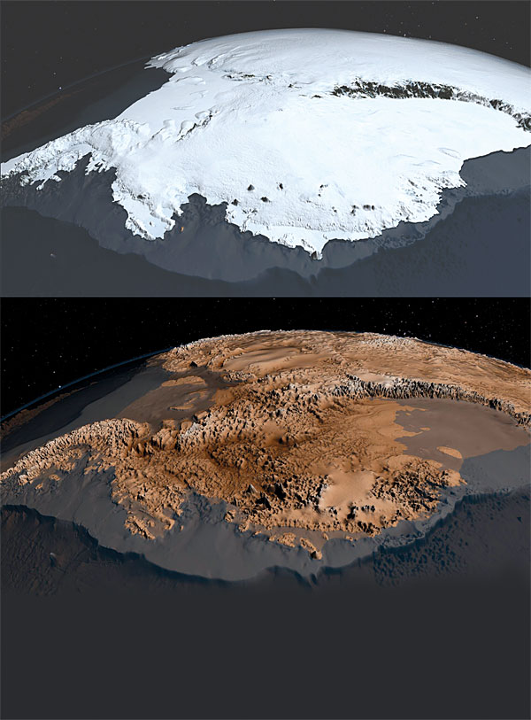
A detailed view of Antarctic topography
DOI: 10.1063/PT.3.2057
Ninety-eight percent of Antarctica is covered by ice. But hidden underneath is a landscape of mountain chains, valleys, basins, and deeply carved troughs. An international team led by Peter Fretwell and Hamish Pritchard of the British Antarctic Survey has now determined that landscape, and the thickness of the ice sheet above it, with unprecedented detail. To derive the new maps, dubbed Bedmap2, the collaborators compiled decades of geophysical and cartographic data from a variety of sources, including satellite altimetry, interferometry, and gravity missions as well as airborne radar surveys and seismic soundings. The ice-sheet thicknesses in particular were determined from 25 million measurements, two orders of magnitude more than were used for the original Bedmap in 2001. Not only are the data more dense, they are also more precise and cover a larger geographic extent. Thus Bedmap2 reveals numerous new surface and subglacial features, plotted with 1-km resolution.
Compared with the 2001 statistics, the Bedmap2 data indicate a larger volume of ice and a lower mean bedrock elevation; the potential contribution of Antarctic ice to global sea-level rise is 58 m (up from 57 m). The details of the ice thickness and the terrain below it are essential for modeling the future evolution of the ice sheets. (P. Fretwell et al., Cryosphere 7, 375, 2013, doi:10.5194/tc-7-375-2013 . Images by NASA’s Goddard Space Flight Center.)
To submit candidate images for Back Scatter, visit http://contact.physicstoday.org .


