An IR view of Eyjafjallajökull
DOI: 10.1063/1.3455264
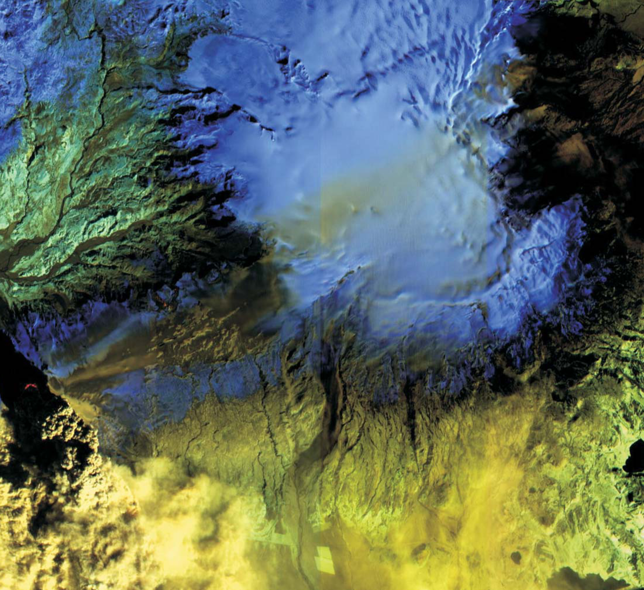
As Physics Today, went to press, Eyjafjallajökull was still erupting in southern Iceland. Three days after the volcano began its explosive ejection of ash into the jet stream on 14 April 2010, the Advanced Land Imager aboard NASA’s Earth Observing-1 spacecraft obtained this false-color IR image of the volcano and surrounding region. The crater is visible (red, far left) at the base of the massive, dense plume. Above and to the right, the fainter red feature—about 8 km away—marks the lava flows in the mountain pass of Fimmvöröuháls, where the eruption began on 20 March. With no ice cap over the lava fissures there, that initial episode lacked the violent lava-water interaction that contributed to the damaging Eyjafjallajökull plume. Additionally, the Eyjafjallajökull lavas are more viscous than those from Fimmvöröuháls and thus are more efficient at trapping gas, which is released explosively. Farther to the east, ash can be seen partially covering the Mýrdalsjökull ice cap (blue), beneath which slumbers the larger and more dangerous Katla volcano. Each of the three most recent eruptions of Eyjafjallajökull, in 920, 1612, and 1821–23, has triggered subsequent Katla eruptions. Katla, one of the most active volcanoes in Iceland, has been showing signs of unrest since 1999; it last erupted in 1918.
To submit candidate images for Back Scatter, visit http://www.physicstoday.org/backscatter.html .

(Image courtesy of NASA/JPL/EO-1 Mission/GSFC/Ashley Davies).


